(707) 839-5130 | Contact Us
Geographic Information Systems (GIS)
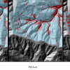
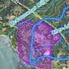
Pacific Watershed Associates (PWA) maintains full Geographic Information Systems (GIS) services to support the development of geologic and geomorphic investigations, erosion control and erosion prevention plans, and watershed and ecosystem restoration projects. Our team consists of natural resource-based GIS specialists skilled in the use of the latest GIS software and hardware. Our skilled professionals incorporate digital satellite imagery; historic and current aerial photography; existing geologic and landscape information; and CAD, Global Positioning Systems (GPS), LiDAR and survey data to support project analysis, conduct digital and spatial modeling, and provide logical answers to project questions. PWA has expertise in the use of GPS and maintains survey capabilities that allow us to obtain unique, site-specific geographic data.
Our services include:
- Digital data acquisition
- Data projection conversion
- Legacy Conversion (historic aerial photography, satellite imagery, CAD to GIS)
- Topographic mapping
- Topographic surveying
- Map digitizing
- Geospatial analysis
- GIS-based modeling
- Digital and paper map products including large format prints